Citizen science isn’t new. People have been counting birds, logging weather, and cataloguing plant species for centuries. What’s new is scale. A smartphone with a camera, GPS, and a decent internet connection turns any person into a sensor — and a few well-designed apps have turned millions of those sensors into research networks that professional scientists couldn’t replicate at any budget.
From a mobile development perspective, these apps are some of the most interesting products being built right now. The technical challenges are real, the user bases are massive, and the impact is measurable.
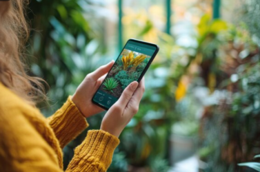
iNaturalist: Computer Vision Meets Biodiversity
iNaturalist is the standout example. Upload a photo of a plant, insect, or animal, and the app uses a convolutional neural network trained on tens of millions of community-verified observations to suggest an identification. Users confirm or correct, the model improves, and the data feeds into the Global Biodiversity Information Facility — one of the largest biodiversity databases in the world.
What Makes It Work (Technically)
- On-device inference for quick suggestions, with cloud-based refinement for edge cases
- Community verification loop — AI suggests, humans confirm, model trains on the correction
- Open API — researchers can query the dataset for studies on species distribution, migration patterns, and habitat changes
- Offline capability — critical for field use where connectivity is unreliable
The app has logged over 150 million observations across nearly 400,000 species. From a development standpoint, the combination of machine learning, community moderation, and open data architecture is a case study in how mobile platforms can serve scientific infrastructure.
Pollution and Environmental Quality Monitoring
Several apps now enable crowdsourced environmental monitoring at a level that was previously only possible with professional equipment:
AirVisual (IQAir) — real-time air quality data aggregated from personal sensors, government monitoring stations, and satellite data. The app’s value increases with each user who connects a personal AQI sensor, creating hyperlocal pollution maps.
Marine Debris Tracker — developed by NOAA and the University of Georgia, this app lets users log marine litter by type and GPS location. The dataset has been used in peer-reviewed research on plastic pollution patterns.
Globe Observer (NASA) — collects cloud observations, land cover photos, and mosquito habitat data that cross-reference with satellite observations. NASA uses discrepancies between ground-level and satellite data to improve model accuracy.
The Development Challenge
Environmental monitoring apps face constraints that most consumer apps don’t:
- Battery optimization is critical — field researchers can’t charge mid-expedition
- Data accuracy must be validated against known standards
- Offline-first architecture is non-negotiable for wilderness use
- Low-bandwidth syncing — uploading high-resolution images from a forest with one bar of signal requires smart compression and queuing
These are solvable problems, but they demand thoughtful engineering.
Wildlife and Habitat Tracking
Merlin Bird ID (Cornell Lab) identifies birds by sound — hold your phone up, and the app matches audio against a trained model to tell you which species are calling. The technology works well enough that researchers use it alongside professional recording equipment.
Seek by iNaturalist — a gamified version of iNaturalist aimed at younger users. Encourages species identification through challenges and achievements. The engagement design is smart — it applies mobile gaming mechanics to field biology.
eBird — the most established bird observation platform, with a mobile app that feeds data into one of the largest ecological datasets managed by any university. The eBird dataset is cited in hundreds of published papers annually.
Educational platforms covering nature, science, and environmental discovery frequently reference these tools as entry points for people interested in ecology but unsure where to begin. The apps lower the barrier from “I’d like to learn about wildlife” to “I just identified a bird in my garden” in about thirty seconds.
What’s Next
The convergence of better sensors, faster on-device ML models, and growing public interest in environmental issues means this category will keep expanding. Edge computing — running complex models on the phone itself rather than in the cloud — is the next inflection point. When a phone can run a full species identification model without any internet connection, the utility in remote field conditions improves dramatically.
For mobile developers looking for meaningful work, environmental and citizen science apps sit at a rare intersection: genuine technical challenge, growing user demand, and real-world impact that goes beyond engagement metrics.
Key Takeaway: The most impactful mobile apps aren’t always the ones with the biggest user counts. Sometimes they’re the ones turning phones into scientific instruments.
Related Reads: